GREENBELT LOCATIONS
The WPOA greenbelt map shows, in blue, where our greenbelts are. There is one pink section that is a Thurston County parcels. We’ll be working with the Assessor next year to address this, but, for the moment, it is NOT WPOA property. The pink boxy area along Boulevard is the water catchment pond, and that is definitely Thurston County’s responsibility.
This map does not show all of the islands in the development. All islands are Thurston County property and are maintained by them, not WPOA. If you see a problem with one of the islands, please contact Thurston County Public Works.
GREENBELT SURVEY
In the fall of 2018, the Board surveyed homeowners about the greenbelts. The Board is using this feedback as we move ahead with greenbelt/common area concerns.
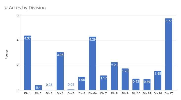
The chart below shows how many acres of greenbelt is in each Division.
Find your division on the Plat Maps.
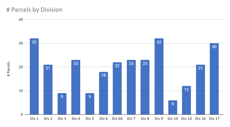
The chart below shows the number of homeowner parcels (lots) per Division.